
Bothell ZIP Coverage Areas
Bothell postal coverage is not a clean outline of the city. Official city GIS includes a ZIP Codes layer, while USPS provides the final delivery code for one address. The working list below records Bothell-area ZIPs supported by the research, but it is not presented as an exhaustive city-limit list. That distinction matters. Postal service areas change for delivery needs, and a ZIP code can cross a city or county line.
| ZIP Code | Areas Covered | Post Office | Notes |
|---|---|---|---|
| 98011 | Core Bothell mailing area | Bothell Post Office | Verify city and county for each parcel |
| 98012 | North Bothell, nearby Mill Creek, and unincorporated areas | Verify by address | Postal city can differ from city limit |
| 98021 | Bothell and Woodinville-adjacent north/east area | Verify by address | Regional postal coverage |
| 98041 | Limited Bothell postal use | PO Box service | Not a physical neighborhood |
| 98072 | Woodinville postal area with regional overlap | Verify by address | Postal name does not settle city jurisdiction |
The 98011 core includes service through the Bothell Post Office at 10500 Beardslee Boulevard. The 98012 label often signals the Snohomish side or nearby unincorporated land, but it is not proof. ZIP 98041 is a PO Box or limited-use clue, not a neighborhood shape. Addresses in 98021 and 98072 need the same address-level check. Use the USPS address lookup, then compare the city county map and parcel record.
Bothell 98011 Postal Core
ZIP code 98011 is the clearest Bothell postal anchor. The main post office lists weekday service from 8:30 a.m. to 5 p.m., Saturday service from 9 a.m. to 1 p.m., and phone 425-482-9755. Those facts support delivery questions, not land ownership or city jurisdiction. A parcel still needs its county assessor and GIS record.
When a person supplies a 98011 address, standardize the street line through USPS first. Then place the point on the city county map. If the goal is a public owner record, search the correct assessor by address or parcel number. The ZIP code directory narrows the area, while the parcel system supplies the situs address, which means the physical location recorded for the land.
Note: USPS confirms delivery formatting, while the assessor and city map answer different questions about land and jurisdiction.
Bothell 98012 Boundary Clues
ZIP 98012 is associated with north Bothell, nearby Mill Creek, and unincorporated Snohomish County. City material points to the area north of 208th Street Southeast, State Route 524, and Maltby Road as a useful context clue. It cannot replace the parcel map. A Bothell postal address may sit beyond the municipal line, so city services and county records may not follow the mailing label.
This is the ZIP code directory's central caution. Start with delivery geography, then test the address against Snohomish County's property tools and the city boundary. Older sources may call the same area North Creek, Canyon Park, or unincorporated county. Search those place names when a current Bothell label produces no historical hit. Annexation dates also matter because the modern city line does not describe every earlier record.
Verify Bothell Regional ZIPs
ZIPs 98021 and 98072 show why a postal city name should not control a records search. The first covers a Bothell and Woodinville-adjacent area. The second uses a Woodinville postal label but can overlap the broader Bothell region. Neither label alone proves that land lies inside or outside Bothell. Check the full address at USPS and place its parcel on the county map.
ZIP 98041 works differently. It is tied to PO Box or limited postal use, so it should never be drawn as a residential district. A box can receive mail without identifying a home, parcel, or county. The research did not find one official static source with every ZIP touching the city limit. Keeping that gap visible is more accurate than turning a regional list into a false border.
Search Bothell Residents by ZIP
A ZIP code can narrow a search, but the inspected county property portals do not offer one universal ZIP-wide resident list. King Parcel Viewer searches an address, parcel, or condominium. Snohomish tax and property tools accept property or mailing address details, yet the public pages did not expose a general ZIP-only property filter. Search one verified address, then move to its parcel and county. Do not claim that the tax-roll owner is the current occupant.
- Enter the full street address in the official USPS lookup. Save the standardized mailing city and five-digit delivery ZIP.
- Use Bothell's city county map or county GIS to decide whether King County or Snohomish County holds the parcel record.
- Search the matching assessor by address or parcel. Keep situs and mailing fields separate.
- Use MyVote only for a voter's own lookup, or follow the lawful voter-file request rules and protected-address limits.
Once the result has narrowed to a road, the Bothell street directory explains the street-level parcel workflow. That step is more precise than trying to infer a household from a ZIP. County election offices can answer precinct or historical-list questions, but Washington's public voter fields and use restrictions still apply.
Bothell USPS ZIP Check
The USPS tool is the authoritative final check for a particular delivery address. It is address-keyed rather than person-keyed. Enter the street address, city and state, then read the standardized ZIP response. The result does not name an owner, establish occupancy, or show whether the parcel lies within Bothell. Its job is mail routing.
| Search field | Use in the ZIP check | What it cannot prove |
|---|---|---|
| Street address | Matches a delivery point | Current resident |
| City and state | Helps standardize the mailing line | Municipal boundary |
| ZIP result | Returns delivery code | County jurisdiction |
Open the USPS address-to-ZIP form represented in the captured image.
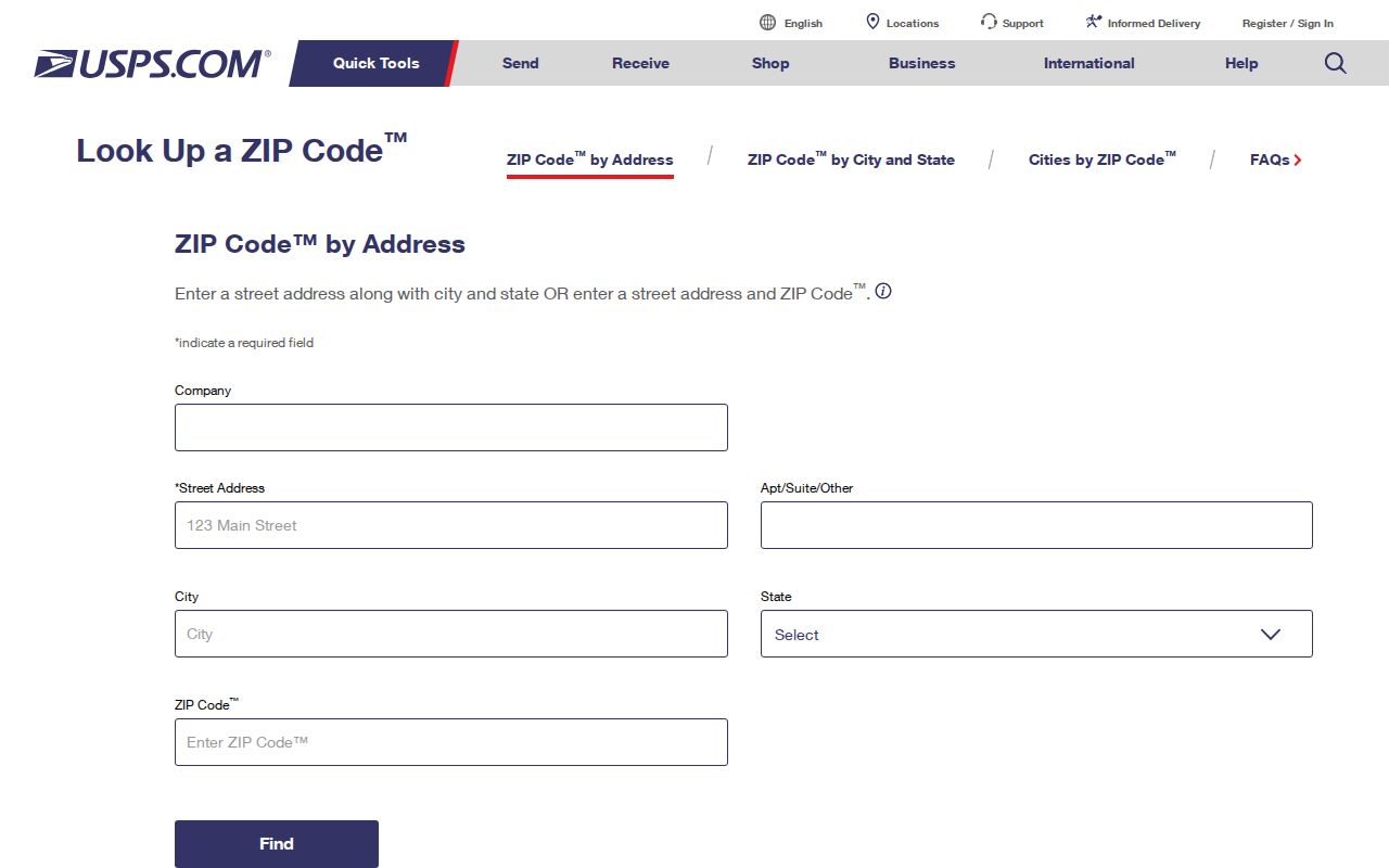
The capture reinforces the proper sequence: verify one mailing address, then use local GIS for its boundary and parcel.
Open the Snohomish tax search when a Bothell address falls on that county side.
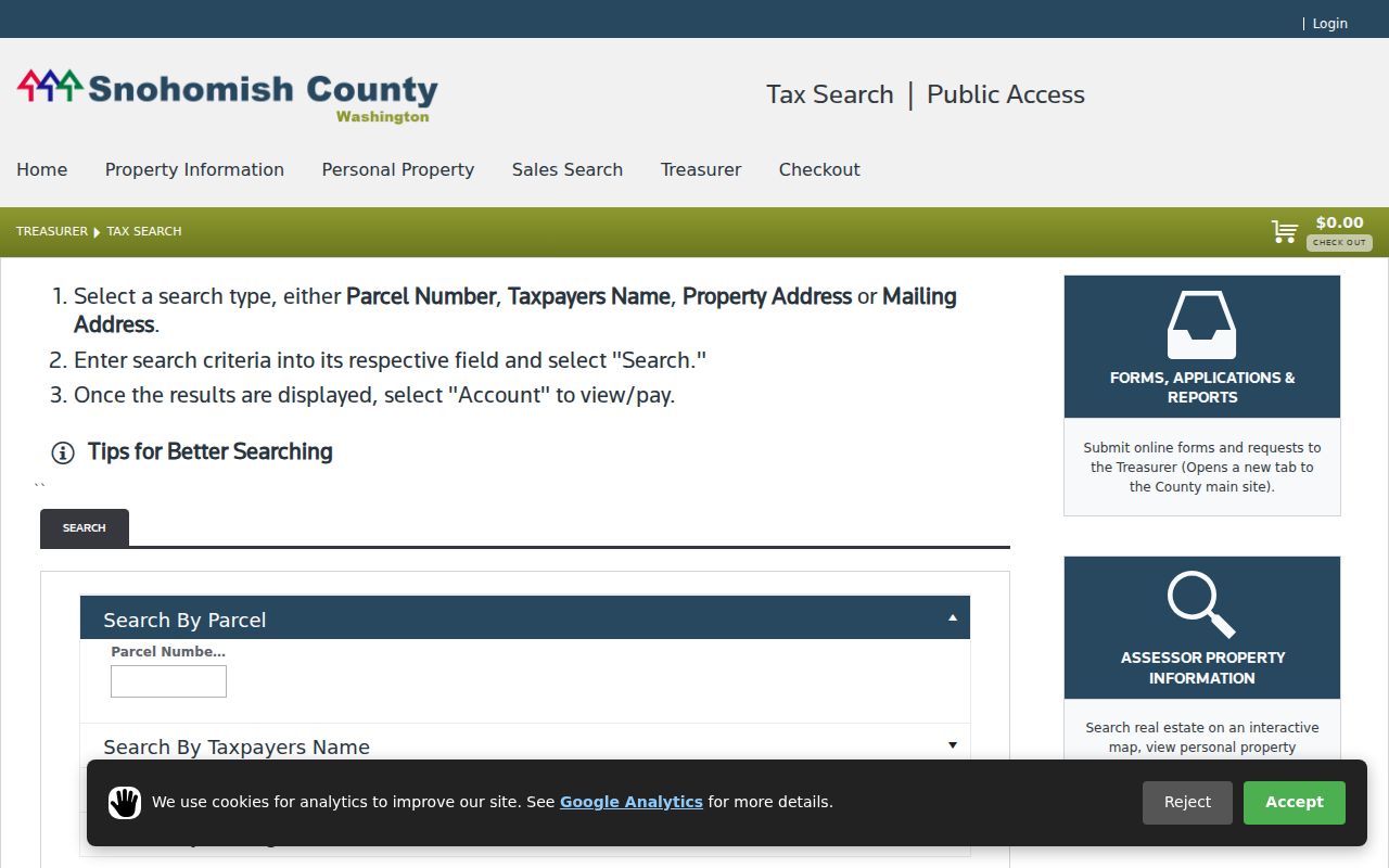
Its parcel, taxpayer, property-address, and mailing-address modes offer a county record check after the postal ZIP is known.
Bothell ZIP and Parcel Keys
A ZIP identifies delivery routing. A parcel number identifies land within a county system. King County property routes commonly use the first ten digits of the parcel number, while a Snohomish real-property parcel number has fourteen digits. Legal descriptions may name a lot, block, subdivision, or metes-and-bounds description. That stable land description helps when the street line or postal label changes.
The Snohomish Property Summary Search and King Parcel Viewer serve different county sides. Neither should be mistaken for a ZIP-wide roll of Bothell residents. Use GIS to place the parcel and assessor data to read public owner and tax fields. Recorded plats and deeds help when old address wording breaks the link.
Bothell ZIP History Context
Bothell incorporated in 1909, but the present city shape came later. The Canyon Park annexation in 1992 added about 10,000 residents and 3,840 acres. Remaining King County potential-annexation areas joined the city at the same time in February 2014, while a Snohomish County urban-growth area remained. Those changes affect how an old address was described even when its current mail still says Bothell.
Search old records under the county and place name used at the time. North Creek, Canyon Park, Mill Creek, Woodinville, and unincorporated county can be useful terms. Official research did not confirm a citywide street-renumbering date, so bridge uncertain addresses through parcel number, legal description, plat, cross street, and historic map. Do not invent continuity from a modern ZIP code.
Bothell ZIPs Versus City Limits
USPS ZIPs serve mail. Bothell's city line sets municipal jurisdiction, and the King-Snohomish boundary sets many record custodians. Those three outlines do not match. A mailing line that says Bothell may be outside the city. A parcel inside the city may use a nearby postal name. Always keep the postal result, city map, and county parcel record as separate evidence.
- ZIP and ZIP+4
- A five-digit delivery area and its added four digits for a smaller delivery segment.
- PO-box ZIP
- A code used mainly or only for post-office boxes, not a mapped residential neighborhood.
- Unique ZIP
- A code assigned to one high-volume recipient rather than a normal street area.
- Carrier route
- The postal path used to deliver a group of addresses within a ZIP.
Census ZIP Code Tabulation Areas add a fourth geography. They approximate postal service areas for statistics and can differ from live delivery boundaries. Some are noncontiguous, unique, or box-only. Never label a ZCTA population as the population inside Bothell's city-limit portion of the same ZIP code.
Boundary check. Use USPS for delivery, Bothell GIS for the city line, and the matching county parcel system for land records.
A careful ZIP code directory ends with address-level confirmation. If the official sources do not show a complete static city list, preserve that limit. The full address is the key that turns a broad postal area into the right county, parcel, and public-record path.